Introduction
Ghana, a vibrant and culturally rich country located in West Africa, spans approximately 238,535 square kilometers (92,099 square miles), making it slightly smaller than the United Kingdom. Known for its diverse landscapes, rich history, and welcoming people, Ghana offers a unique blend of natural features and cultural heritage.
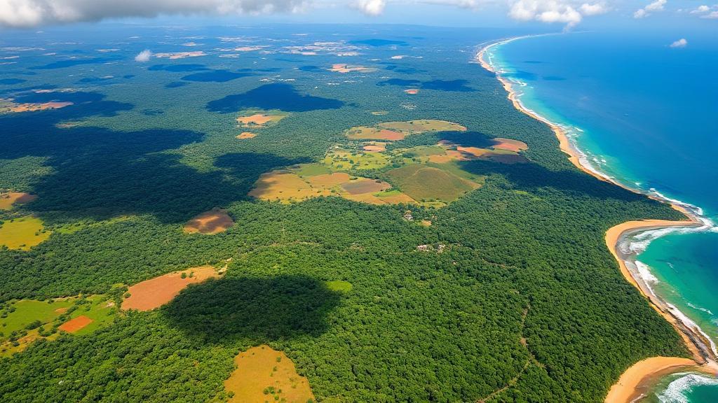
Geographic Location and Boundaries
Ghana is situated on the west coast of Africa, lying between latitudes 4° and 12°N, and longitudes 4°W and 2°E. The country shares borders with:
- Ivory Coast (Côte d'Ivoire) to the west
- Burkina Faso to the north
- Togo to the east
- Gulf of Guinea (Atlantic Ocean) to the south
Physical Features
Terrain and Elevation
Ghana's landscape can be divided into five distinct geographical regions:
- Coastal Plains: A narrow strip of low-lying sandy beaches, lagoons, and ridges
- Ashanti Uplands: Rolling hills and fertile forests
- Volta Basin: The largest geographical region, characterized by gentle slopes
- Northern Plains: Consisting of relatively flat savanna
- Akwapim-Togo Ranges: A chain of hills running along the eastern border
Mount Afadjato, standing at 885 meters (2,904 feet), represents Ghana's highest point and is a popular hiking destination.
Water Bodies
The Volta River system dominates Ghana's hydrography, including:
- Black Volta
- White Volta
- Red Volta
- Oti River
Lake Volta, created by the Akosombo Dam, is one of the world's largest artificial lakes by surface area, covering approximately 8,502 square kilometers.
Climate
Ghana experiences a tropical climate with regional variations:
The country has two main seasons:
- Wet season (April to mid-November)
- Dry season (December to March)
Temperatures generally range from 21°C (70°F) to 32°C (90°F), with coastal areas being more humid and northern regions experiencing more extreme temperatures.
Natural Resources and Environmental Challenges
Ghana is rich in natural resources, including:
- Gold (earning it the colonial name "Gold Coast")
- Diamonds
- Bauxite
- Manganese
- Oil and natural gas
- Timber
- Rich agricultural lands
"Deforestation, improper disposal of waste, coastal erosion, and illegal mining (galamsey) pose significant threats to Ghana's environmental sustainability." - Ghana Environmental Protection Agency
Agricultural Zones
The country's geography supports diverse agricultural activities:
-
Forest Zone
- Cocoa cultivation
- Oil palm plantations
- Rubber trees
-
Savanna Zone
- Cereals (millet, sorghum)
- Cotton
- Livestock grazing
-
Coastal Zone
- Coconut plantations
- Salt production
- Fish farming
For more information on Ghana's geography and travel tips, you can visit Ghana Tourism Authority and Lonely Planet's Guide to Ghana.