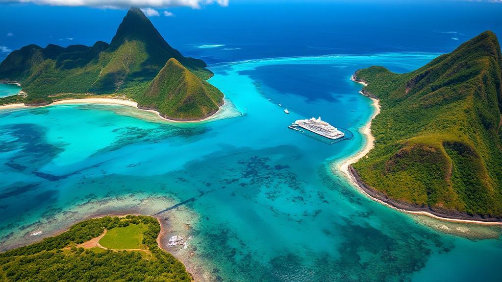
Introduction to Saint Lucia
Saint Lucia is a stunning island nation located in the eastern Caribbean Sea, part of the Lesser Antilles archipelago. Situated between Martinique to the north and Saint Vincent and the Grenadines to the south, with Barbados to the southeast, this volcanic island is known for its lush landscapes, vibrant culture, and iconic landmarks.
Geographic Location and Coordinates
Saint Lucia lies at approximately 13°53'N latitude and 60°58'W longitude, covering an area of about 617 square kilometers (238 square miles). The island is bounded by:
- Caribbean Sea to the west
- Atlantic Ocean to the east
- Martinique Channel to the north
- Saint Vincent Passage to the south
Neighboring Islands
- Martinique: Located about 34 kilometers (21 miles) to the north
- Saint Vincent and the Grenadines: Situated approximately 40 kilometers (25 miles) to the south
- Barbados: Lies about 174 kilometers (108 miles) to the southeast
Physical Geography and Natural Features
The Pitons
One of Saint Lucia's most striking features is the Pitons, two volcanic spires rising dramatically from the southwestern coast:
- Gros Piton (2,619 feet/798 meters)
- Petit Piton (2,461 feet/750 meters)
These UNESCO World Heritage sites are popular hiking destinations and serve as symbols of the island.
Other Notable Features
- Mount Gimie - The highest point at 950 meters (3,117 feet)
- Sulphur Springs - The Caribbean's only "drive-in volcano"
- 158-kilometer (98-mile) coastline with black and white sand beaches
- Protected coral reefs
- Diverse environmental zones including:
- Coastal mangroves
- Rainforests
- River valleys
- Agricultural lands
Climate and Weather
Saint Lucia experiences a tropical climate with:
- Average temperatures between 22°C-30°C (72°F-86°F)
- Dry season: December to May
- Wet season: June to November
- Annual rainfall: 60-150 inches, varying by region
Major Population Centers
| City | Description |
|---|---|
| Castries | Capital city and major port |
| Soufrière | Historic town near the Pitons |
| Vieux Fort | Location of international airport |
| Gros Islet | Popular tourist destination |
Transportation and Accessibility
Saint Lucia is accessible via:
- Hewanorra International Airport (UVF) in Vieux Fort
- George F. L. Charles Airport (SLU) near Castries
- Multiple seaports for cruise ships and cargo vessels
- Regular ferry services to neighboring islands
Cultural and Economic Significance
The island's strategic location has shaped its development, with tourism and agriculture forming the backbone of its economy. The official language is English, though many locals speak Kwéyòl, a French-based Creole. The Saint Lucia Tourism Authority provides resources for visitors interested in exploring the island's rich cultural heritage and natural beauty.
Conservation Efforts
The Saint Lucia National Conservation Fund works to protect the island's natural resources, supporting conservation projects and promoting sustainable development. The island is home to diverse wildlife, including the Saint Lucia parrot, the national bird.
